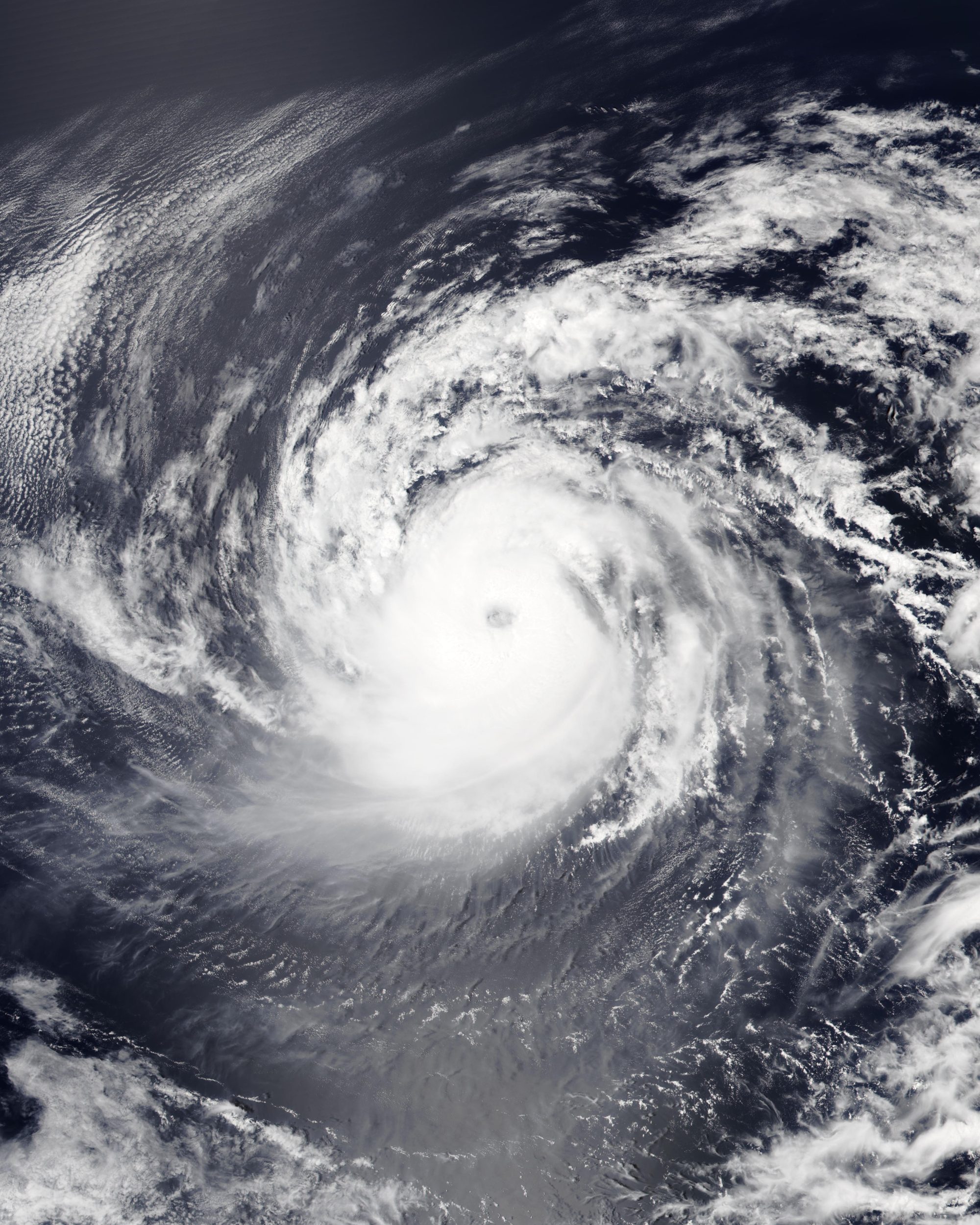
Dangerous surf from Hurricane Karina will hit LA County beaches through midweek while a second Pacific disturbance could track toward Southern California.
Hurricane Karina intensified rapidly on Sunday, Aug. 30, reaching Category 4 strength with 145-mph sustained winds, according to the National Hurricane Center's Advisory #16. The storm sat about 1,020 miles west-southwest of the southern tip of Baja California and was moving west at 9 mph. No coastal watches or warnings were in effect.
Karina poses no direct land threat. But the NHC warned that swells from the storm would reach Southern California from Monday, Aug. 31, through Wednesday, Sept. 2, bringing life-threatening surf and rip current conditions. The National Weather Service separately warned of high rip-current risk along LA County beaches, with surf up to 6 feet.
The more closely watched system is a separate tropical disturbance the NHC has designated EP95. As of late Sunday, the NHC gave EP95 a 90% chance of becoming a tropical depression within 48 hours, the Times of India reported. The disturbance was well offshore southwestern Mexico, moving northwest at 10 to 15 mph.
The NHC had not issued an official track or intensity forecast for EP95 as of Sunday night. Projections of a possible Southern California approach remain model scenarios, not official forecasts.
KTLA meteorologist Kaj Goldberg said weather models showed EP95 could develop an eye off the coast of Baja California by Friday, Sept. 4, potentially reaching hurricane strength by Friday or Saturday before weakening. In that scenario, it could make landfall in Southern California as a tropical storm, bringing heavy rain, extreme humidity and possible flooding.
"This is the disturbance that, if it does form and come together, could make its way right into Southern California about one week from today," Goldberg said Sunday, Aug. 30.
National Weather Service meteorologist Bryan Lewis told KTLA that the NHC initially predicted an 80% chance of a tropical depression forming from EP95 within 48 hours and a 90% chance within seven days. The NHC later raised the 48-hour probability to 90%.
A hurricane has never made landfall in California in recorded history, according to the National Weather Service. Lewis told KTLA the last tropical storm to make a direct Pacific-to-California landfall was in 1939. Hurricane Nora crossed into Southern California in September 1997 still at tropical storm strength, causing rain, rough surf and slick roads. The California Highway Patrol documented three or four traffic deaths, and 125,000 power customers in the LA area lost electricity, the Daily Mail reported.
The most recent tropical system to reach the state was Hurricane Hilary in August 2023. Lewis told KTLA that Hilary brought significant rainfall and impacts to Southern California but had weakened below tropical storm strength before arriving.
Warmer-than-normal ocean conditions may be fueling the active storm season. KTLA reported sea surface temperatures along LA County beaches were running 5 to 10 degrees above normal, at 74 to 76 degrees. NOAA's Climate Prediction Center has said El Niño is strengthening, with a greater than 90% chance of becoming a very strong event during the fall and winter of 2026–27.
As of Sunday, no public statements from LA County's Office of Emergency Services, the LAFD, LAPD or the mayor's office addressed preparedness for the EP95 threat. The NHC is expected to issue an official track forecast once EP95 forms into a tropical depression.