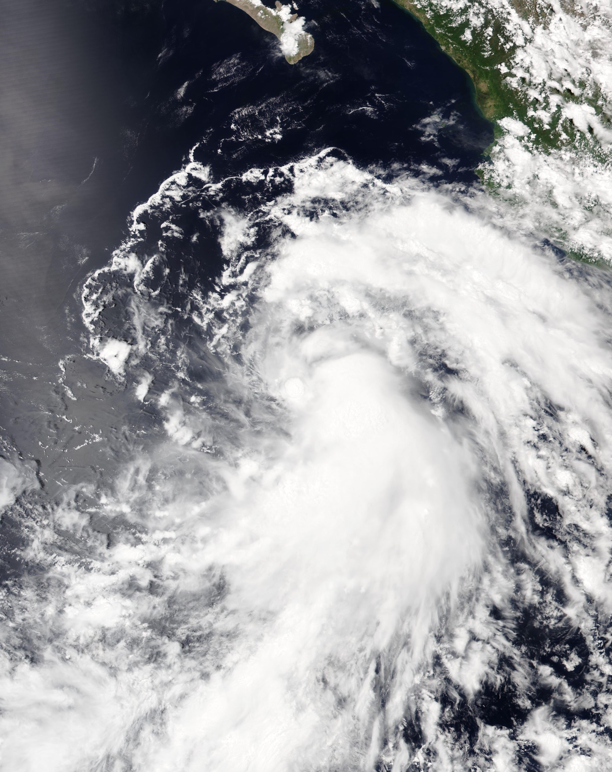
Tropical Storm Marie could send dangerous surf and coastal flooding toward Los Angeles beaches over Labor Day weekend.
The storm formed several hundred miles southwest of Mexico on Tuesday, Sept. 1, with maximum sustained winds of 45 mph and a northwest track at about 9 mph, the National Hurricane Center (NHC) reported. The NHC expects Marie to reach hurricane strength by Thursday, Sept. 3, then move toward Southern California through Saturday, the Los Angeles Times reported.
The storm won't make landfall here. Ocean temperatures off Southern California sit in the high 60s to low 70s, well below the roughly 80-degree threshold needed to sustain a hurricane, according to Sebastian Westerink, a meteorologist with the National Weather Service's (NWS) San Diego office.
The biggest near-certainty: large waves and strong rip currents at LA-area beaches all weekend.
"There's increasing confidence in moderate-to-large surf from the south swell starting as early as Friday," Kristan Lund, a meteorologist with the NWS Oxnard office, told the Times. "We could have coastal flooding because we'll have above-normal tides during the same time, especially along south-facing shores."
Evening high tides are forecast to reach 6.5 to 6.8 feet Sunday and around 7 feet Monday, according to the NWS. The weather service identified Catalina Island, the coastline from Long Beach to Cabrillo Beach, Malibu and Point Mugu as areas especially vulnerable to flooding, KTLA reported.
As we reported Aug. 31, swells from Hurricane Karina were already hitting the coast. Marie's swells will compound that threat.
Beyond surf, the forecast gets murkier. The NWS said only 5% to 10% of model projections show 2 inches or more of rain over the weekend. About 20% to 30% of projections show no rain at all. Light rain is the likeliest outcome, according to the Eastsider LA.
There is also a low chance of strong northeast winds that could knock down trees and raise wildfire concerns, the NWS said.
University of California climate scientist Daniel Swain told the Times a more likely medium-impact scenario involves a weakened tropical storm bringing breezy conditions, heavy moisture, showers and thunderstorms. He noted that heavy mountain rainfall could trigger flash floods and debris flows.
NWS Los Angeles posted on X on Tuesday that residents should expect strong rip currents and large waves regardless of the storm's final track. Other details were still being worked out, the agency said.
Forecasters said the storm's path after Saturday remains highly uncertain. Some models show it pushing through Southern California by Monday or Tuesday. Others have it turning west and staying offshore with little local impact.
The NWS expects the forecast to sharpen by midweek once the storm fully forms. Quiet weather with below-normal temperatures and coastal clouds is expected across Los Angeles through Friday before conditions potentially shift over the weekend.